I've dreamed of an extended hike on the Appalachian Trail
 (which extends over 2,000 miles from Georgia to Maine) for years, but life always seemed to get in the way. This year I decided to make it happen. My wife, Chris, graciously agreed to my absence for an extended period and I started my planning. I decide to do an inital segment of 2-3 weeks to test myself and my equipment, and then to do a longer segment of up to a couple of months if my mind and body held out on the inital segment.
I did a lot of reading to plan my hike. I also spent about 4-6 hours over 3 days at the REI stores in Raleigh, NC and San Francisco, CA testing out packs, tents, boots and other gear. I consciously decided not to go "ultralight" as I wanted a bit more creature comforts. In other words I chose a 2 person tent so that I would have room for my pack in the tent. I chose a long sleeping pad rather than one that of hip length, and a few other things like that. I also decided that I would forgo sending myself resupply packages to Post Offices and would go with what I could carry or purchase along the way. My guess was that I would be carrying 40+ lbs including food and water.
After purchasing most of my gear, my neighbors soon got used to seeing me walking the dogs while in hiking boots and lugging a large pack as I tried myself to get ready, all the while recognizing that the totally flat environment of Hertford, NC would bear little resemblance to the rugged ups and downs of the Appalachian Trail (AT).
Note: I kept a paper journal during my hike. This blog is a transcription of that journal ....
The AT begins at Springer Mountain above Amicalola Falls State Park, GA. It is normal for hikers to sign in at the Visitor Center at the Falls and then to climb close to 8 miles to the start on Springer or to get a ride to the back side of Springer on Forest Service roads for a much shorter approach. I much preferred the 2nd option as I'd climbed the 600+ steps on the Falls trail many years before and wasn't really interested in doing it again, especially with a heavy pack. Don graciously agreed to the somewhat out-of-the-way trip to the northern side of Springer.
 as my trail name. It is tradition that long distance AT hiker assume a trail name. Since I already have one nickname, I saw no need for another.
  Mountain, following a combination of tertiary roads and unpaved forest service roads.
 Don dropped me off at the parking area off the trail at about 2:15 PM. I shook his hand, donned my heavy pack, and headed up the mountain.
 camera to avoid a repeat of the problem; gave Don the case to ship home for me, and headed up the trail once again. It was now 4:15 PM. Taking this route, the summit of Springer Mountain and the official "start" or "mile 0" of the the AT is only about a mile's hike uphill. I made the summit at 4:45 PM.
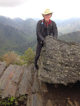
 and signing the register which is kept in a steel box inside a huge boulder
 . I paused to admire the views and then retraced my steps down the mountain as I officially headed north on my first long-distance AT adventure.
 I stopped at the first stream and filtered water for my 2 liter hydration bladder. There is a pocket for the bladder in my pack. I have a sip hose so that
  I can drink water without stopping. I also have another water bottle that I can fill if there is more than 3-4 miles til the next water source and a larger collapsible water container that I can fill each evening for camp.
- Find water source
- Remove pack from back
- Remove and assemble water filter
- Remove water bladder and attach to filter
- Place filter in water source and pump vigorously for a few minutes until water container(s) are filled
- Drink as much water as you can then pump some more to refill container(s)
- Disassemble water filter, then place it and water containers back in pack
- Hoist the now much heavier pack (water weighs 2.2 lb /liter) onto your back and walk on.
For those of us used to simply sticking a glass under a tap or opening a bottle, this takes a bit more time. The water process usually takes about 15 minutes, and is done several times a day.
 Meanwhile back on the trail, it's a lovely morning and I'm excited to be here. By late morning, I was climbing steadily. As long as you keep an eye out for the rectangular white blazes on trees and rocks, you can easily navigate the trail.
The first 2 mountains I did fine, but the 3rd one, Sassafras Mountain, really kicked my a**! It was over a mile straight uphill.
About 3:30 PM I stopped for a much-needed break near the top and started to offload my pack onto a rock ledge at the side of the trail. (You soon learn to find anything elevated -a stump, ledge or log, to minimize lifting and make it easier to get your heavy pack off and back on). As I leaned far back to get the pack straps off, I suddenly felt very dizzy. The next thing I knew, I woke up 10 feet down the bank below the ledge with my head bleeding profusely and a very sore shoulder. I can only figure that I somehow passed out and the weight of the pack pulled me over the edge. I used my bandanna and applied direct pressure to stop the bleeding after a few minutes, then used the same bandanna and water from the hydration bladder to clean up my face and arms. I sat for a few minutes to get myself together, then grabbed my pack and climbed back up to the trail. I had been very lucky....
I would have preferred to camp immediately, but I was 3+ miles from the nearest water source so I had to keep moving. I actually ran out of water before finishing for the day.
I somehow managed to climb, albeit very, very slowly, 2 more mountains, and got to Justus Creek Campsite about 4:30 PM. My new friends Stan and Phil from the previous night were there already and I camped near them. It took a bit more time to set up camp this evening as I was rapidly stiffening up from my fall. After I got set up, I got out my first aid kit and asked Phil if he could further clean and put antiseptic on the cuts on my forehead.
This has been one of the toughest days of physical exertion I've ever done -including Ranger training. I'm beginning to realize just how much carrying 52 lbs on my pack at my age can take out of me ,and how important it is to drink, drink and drink more water. I'm sure that my dizziness and fall were caused by dehydration. The heat doesn't help much either and I need to eat more breakfast....
I somehow managed to cook and eat some dinner even though I had absolutely no appetite. I also filtered and drank 96 oz. of water over a couple of hours.
After dinner I needed to rig my food bags on a bear line. There were no pre-installed steel cables at this campsite so I had to find an appropriate tree limb 15-20 feet high, toss a line up and over it, then secure my food bags to the line and hoist them up. When I tied my line to a stick and tried to toss it over a limb, I found out just how sore my shoulders really were...ouch! Several tries later, I managed to clear the limb, and pulled up and secured my food bags.
By 7:30 PM I was in my tent and trying to get to sleep.
Day 3....
I once again tossed and turned all night and was awakened by rolling thunder at 6 AM. I fixed coffee and was just starting to eat my lovely PopTart when the heavens opened up. I quickly grabbed my clothes off the limb where I was airing them out and dived back into the tent. I managed to save my coffee, but the PopTart was a total casualty. I laid back in the tent, sipped my coffee, munched some dried fruit and waited out a terrific thunderstorm for the next 2 hours.
There was only one problem with my campsite. It was at the base of a hillside next to a stream. The rain came down so hard that the water runoff was actually a couple of inches deep under and around my tent and my sleeping pad was floating. Luckily my tent's waterproofing held and I was snug and dry.
The rain ceased about 9:30 and I broke camp and headed out. After about 30 minutes on the trail it started pouring again. I quickly put on my rain suit and pack cover and kept going.
About hour later I came to the Gooch Mountain Trail Shelter and decided to take a break and eat  something in a dry spot until the rain let up. I was eating my PB &J on flat bread when 2 hikers from Tenn: Wes and Travis, came straggling in. I gave them some coffee and trail mix and shared their brew-up. The rain pretty much stopped within an hour or so and I headed back out.
Today's hiking was much better than yesterday in spite of the weather. the terrain wasn't as steep and it was much cooler. I drank a lot more water and also didn't try to push for as many miles.
Since my tent and some of my clothes were wet, I decided to try and stop at the Hiker Hostel in Suches , GA. I called them from the road crossing at Woody Pass on my cell phone and made a reservation. They offered to pick me up but said it would be over an hour before they could get there so I decided to try my hand at hitch-hiking for the first time in 40 years. Within a few minutes a local teacher and his wife gave me a ride to the hostel.
I was pleasantly surprised by the hostel. It is modern and immaculate. The owners Leigh and Josh are excellent hosts and have both thru-hiked the AT. I got a hot shower, washed my clothes in their machine and dried my tent on their back deck. I also weeded a few more things out of my pack and donated some food to their "hiker" box where hikers can leave or take stuff as needed. Dominos delivered a pizza for dinner, and I crashed by 9:30 PM...a very happy camper!
Day 4....
I awoke very refreshed at 6:30 AM. I will freely admit to sleeping MUCH better on an inner-spring mattress than on an inflatable foam pad directly on the ground. The air conditioning didn't hurt either. I got up and snagged an early mug of coffee before anyone else was stirring. Shortly therafter, Josh and Leigh started preparing breakfast which was served at 7:30...french toast, scrambled eggs, oatmeal, raisins, juice and coffee. Not bad for a total of $15. including room and breakfast and a shuttle back to the trail. Washing and drying clothes added another $3.
 There were 7 of us heading back to Woody Gap to continue our treks: 4 young Army officers from Ft. Benning taking a long week-end hike, Wes and Travis from Tenn, and me. Wes at 50 is the closest in age to me; the others are all in their 20's. The Hostel owners, Josh & Leigh, are in the upper right corner of the picture.
The officers were all carrying about 15 lb packs and they moved out fast when we were dropped off. I kept up with them for a few minutes until we started climbing, then slowed way back. My pack weighed in at 48 lb at the hostel, 4 lb less....but still too heavy.
Today my primary objective was to reach and climb Blood Mountain, the highest point on the AT in GA at 4,460 feet. to get there I first had to climb 6 smaller mountains starting at 3,050 feet. Believe it or not, the day was great! Naturally I had a little soreness at first, but it worked itself out (with the help of a little "vitamin I" - Ibuprofin). I think the big breakfast was also a help and I forced myself to drink a lot of water and took more frequent breaks.
I made the summit of Blood Mountain by 3:30 PM. the vistas were amazing and  the approach was blanketed by blooming rhotodendrons and mountain laurels. I had a wood grouse try to lead me away from her nest fluttering her wings and screaming. I also had a brief conversation with a box turtle but he was a bit
  stand-offish. It was also nice to take 5 minutes or so to watch two dueling butterflies having a dashing dogfight all around me: one a brilliant blue and the other bright yellow. I asked myself: "how often do we take the time to watch the butterflies in life these days?"
 I didn't really think I would make it up Blood Mountain today given all
  the vertical, but I guess my body must be getting
 used to this hiking stuff... as I still had energy left. The old stone trail shelter atop Blood Mountain is unique.
Sitting atop Blood Mountain, I remembered a discussion at breakfast that the Hiker Hostel would also pick you up at Neel's Gap where there is a road crossing and an outfitter. As I thought fondly of last night's bed and shower, I decided "what the heck," and pulled out my cell phone. I was able to arrange for a pick-up and room.
  Josh, one of the owners, was waiting for me when I arrived at Neel's Gap around 4:30 PM. My only regret was that I hadn't left my heavy pack at the hostel that morning and borrowed a light day pack for some water and snacks...oh well.
Wes and Travis from Tenn. were also at the outfitter where I met my shuttle and they decided to join me as well. I couldn't believe that I actually bought more food at the outfitter, but I'm trying to find some trail food that has a bit more flavor than instant Knorr-Swiss/Lipton noodles and also something to replace the gosh-awful breakfast PopTarts with something that tastes better and has a lot more calories to get me through the day.
When we got back to the hostel we ordered Italian takeout. I had mussels fra-diablo and a salad....much better than dried noodles augmented by a packet of chicken. After dinner I touched base with Chris and my Mom, took a long shower and rinsed out my sweaty clothes. I finished out the day by planning tomorrow's route, then crashed hard on that lovely bed.
Day 5....
Up at 0630 and breakfast at 0700. This morning we had waffles, grits, eggs, OJ and coffee. We were enroute back to Neel's Gap by 0830.
The only problem with finishing the day at a "gap" is that the next morning starts with up-hill, but that's life. I came upon 2 hikers still in camp about 1/4 mile up the hill. A bear had circled their tent all night within flashlight range and their 2 dogs barked continuously... sounds like a fun night! That'll teach them to camp so close to a place where food is sold!
I kept a close eye out for the next couple of miles, but didn’t see any bears. The 2 women with whom I shared the Low Gap Shelter saw one about a mile from the shelter; they made a noise and it ran off. The only unusual animal I saw this morning was a 4 foot copperhead snake crossing the trail ahead of me. I gave it plenty of room.
Today was up and down, with much more up than down. You quickly grow to appreciate the few relatively flat segments between the ascents and descents. I call them, “a little bit of heaven”….

I got to the Low Gap Shelter about 4:30 PM. I was was joined by Susan
 and Dianne from Kansas about an hour later and 2 more guys arrived around 8 PM. I hadn’t planned to physically stay in any of the shelters, but we were advised by the local “ridge runner,” ( a local who periodically patrols his/her section of the trail) that we should stay in the shelter because of extra heavy bear activity in the area this Spring. As no one else had set up in the shelter by 7 PM, I actually set up my tent in the shelter to protect me from the bugs, which were a real pain/itch outside. The 2 women decided to do the same thing.
For dinner I had a 2-person serving of Mountain House freeze-dried Mexican chicken and brown rice. It was okay except for the heavy dose of olives (that’ll teach me to read the ingredients next time, but I’m not used to Mexican food with ripe olives). I also had a small package of chocolate cookies which I shared with the 2 women and a liter of tea-flavored water (ice would have been VERY nice!). I’d only eaten about half a Cliff bar and some trail mix during the day.
My total mileage for the day was a little over 11 miles. Scenery was beautiful but not as spectacular as yesterday even though there were a couple of nice balds early in the day. By 8:30 PM I’m trying to get to sleep, but last night’s mussels are wrestling with tonight’s Mexican rice – think I’ll munch an Immodium just in case.
Day 6….
Not a great night…. The combination of mice and baby birds nesting on a shelf rustled and cheeped all night long. The mice also knocked my collapsible wash basin off a high shelf where it was drying about 2 AM. It landed with a very loud thud, and woke everyone. Even though I hung my pack from the shelter rafters with cable ties, I had been advised to leave all the pockets open to minimize the chances of mice chewing into them to see what might be inside.
 I had no pack damage in the morning, but the women sharing the shelter had multiple holes chewed in their clothing which was hanging alongside mine on a clothesline in front of the shelter. Notice the front of the woman wearing the blue shirt and you can see where the mice chewed it....When I lowered my food down from the 20 foot high stainless steel bear cables I was really surprised to find that rodents had somehow gotten around the 18” steel anti-rodent cones on the cables and had managed to chew their way into my food bag and into my trail mix( which had 2 types of nuts). Oh well, so much for the trail mix and my once waterproof food bag.
I’m starting to move quite a bit slower in the AM. I think the combination of lack of sleep and heat is getting to me. It was after 11 AM, before I finished my hot bulgur and coffee and repacked everything for the day. I
 was heading for the privy when I noticed a 5 ft black snake that didn’t seem to want to give up his section of the trail. As it didn’t seem to be in any hurry, I went back for my camera. By my return, it had crossed the trail, but I got a shot of it in the leaves along side.
For once, I didn’t have a steep mountain to climb first thing in the morning, which was probably good given my energy level. Although I was ascending, the trail followed an old logging trail for about 4 miles.
 The grade was no steeper than a 12 ox team could pull a wagon load of hardwood logs uphill. It was very nice to have a bit of a break. I can feel the close to a week’s worth of carrying 50 lbs on my hips and shoulders. Even with my late start, the easier terrain allowed me to make good time.
In the early afternoon I saw my first 2 bears: a sow and her cub that were foraging for insects and rodents along side the trail. I tapped my hiking sticks together and they ran off into the woods. I also saw 4 more wild turkey, one of whom flew up into a tree quite near me. I tried to get a picture, but missed him. Additionally, I added 2 quail and another wood grouse to my wildlife list.
 In mid-afternoon, I passed the Chattahoochee Spring, which is the source of the Chattahoochee River from which Atlanta, GA draws its water. I’ve been told that some less reverent hikers used the spot to “urinate on Atlanta.”
As the afternoon progressed, I recognized that if I could climb Blue Mountain within a reasonable time, I might be able to make it down to Unicoi Gap on the mountain’s reverse side. From there, I could hitchhike into Helen, GA and find a room/shower/meal. That thought gave my feet significant inspiration. Coming down the mountain, I met my 3rd bear of the day coming up the trail toward me. This one was a great big boar. Once again, I simply tapped my sticks and he ran off, even though I was fully prepared to yield him the trail.
I made it to Unicoi Gap, a distance of 10+ miles, by 5:30 PM. I then stuck out my thumb and hoped for a ride. About 10 minutes later, I was picked up by a young man returning from a day’s fly-fishing for trout.. As we loaded my pack into the back of his car, we came VERY VERY CLOSE to being crushed by an overtaking truck. Even though there was a 300 yard sightline, and multiple signs saying “SLOW – HIKERS!” the driver was paying no attention and his truck came flying down the mountain directly at us. At the very last moment, he saw us and swerved to the right, off the road and barely missed us. He came close enough that he hit my hiking poles that were leaning vertically against the side of the car and knocked them flying. He eventually brought the truck to a stop, turned around and yelled at us for almost causing an accident. Luckily, the only damage was the scraped up hiking poles and a major adrenaline rush. The guy who picked me up was nice enough to not only drive me the 9 miles into Helen, but to take me from hotel to hotel until I found one with a vacancy and would also shuttle me back to the trail in the morning. I hit the jackpot at the Best Western. In addition, they offered a 50 % discount for AT hikers.
By 7 PM, I was showered, had my clothes soaking in the sink and was ready to make the 15 minute walk to a recommended German restaurant: The Hofbrau House, Upon my arrival, my initial request was for a cold German beer, my first in over a week. Ah, the little things in life that mean so much. It tasted really, really good! I immediately follwed that beer with another one, then added a green salad, large wiener schnitzel, red cabbage and a baked potato. Once the edge was off my appetite, I finished up with apfel strudel and coffee. I then waddled back up the hill to my room and bed.
Day 7….
As the person who was to give me a shuttle ride back to the trail did not come on duty until 10 AM, I had a leisurely morning. I ate breakfast at 0700, then packed up except for my solar charger which I propped up on the window sill to catch the morning sun. By 1000 My pack and I were in the hotel lobby waiting for the General Manager, Ms. Powell, to give me my ride to the AT. She drove me the 9 miles up to the trail in her private car. As I got out of the car, she gave me a card and told me to give her a call if I had any emergencies and she would do her best to help….What great customer service!
The AT from Unicoi Gap goes straight up Rocky Mountain, a climb of
 over 1,000 vertical feet in 1.5 miles. I felt great after my rest and hearty meals and headed up the mountain with a deliberate, but not belabored pace. I was ¾ up the mountain when I suddenly had a real “Oh S***!” moment. I realized that I had left my solar charger on the window sill at the hotel. Luckily, that high on the mountain, I had cell service. I called the hotel and asked them to please check my room for the charger. I said that I would hike down the mountain and hitchhike back into town to retrieve it. A few minutes later, I got a call from Ms. Powell. Not only had they found the charger, but she would drive it up to the base of the mountain and meet me. It took me 30-40 minutes to come back to Unicoi Gap where I only had to wait a few minutes for Ms. Powell and my charger. I was truly grateful! A lot of people have been great along the trail. I’m also lucky (right!) in that most AT hikers only get to climb Rocky Mountain one time while I got to climb it twice with the 2d time being in the heat of the day. It’s really getting hot out here!
After this auspicious start, I simply put my head down and seemed to climb for most of the day. No more bears. Given the heat, I decided to try and find a mountain top campsite which might be a bit cooler than near the shelters which tend to be tucked into the lee of a mountainside. I found a site near what’s called Swag of the Blue Ridge. I had gotten my tent erected and was getting ready to make dinner when I realized that I had found the long lost birth place and dwelling of at least 50 % of the stinging, biting and buzzing insects in the Western hemisphere. Yuck! In order to be able to cook my dinner in peace, I built a small smoky fire with a lot of leaves and twigs. This “smoke pot” seemed to drive a significant percentage of the bugs away, at least temporarily. Normally, I do not like to eat in my tent as I don’t want to take the chance of spilling food which might then draw bears and other critters to the smell. Tonight, however, I made an exception. I beat a hasty retreat into the tent and chuckled at all the thousands of thwarted bugs baying outside the screening. It did not do a lot for my appetite however. This evening I was all by my lonesome on the mountaintop. The bears knew better than to approach the *#@* bugs….
Day 8….
Unfortunately, the temperature never got much below 80 all night and my 20 degree sleeping bag was real overkill. I lay on top of it and perspired all night long. It did not make for good sleeping. At least the bugs seemed to dissipate by dawn. After a quick breakfast, I packed up and headed out. By 10 AM it was really, really hot although I had no thermometer to tell exactly what it was. I do know that I was soaked through and drinking water all the time, but not urinating more than once during the day. If you know me, you’ll know how unusual that is! By early afternoon, I stopped at a shelter, stripped off my shirt and sat down for some lunch. I checked my maps and saw that I could probably make Dick’s Creek Gap by mid-afternoon. From there, it is about 11 miles into Hiawassee, GA, the last town before the NC border. I checked my Hiker’s Guidebook for hotels and gave a couple a call. I got rooms at 2 hotels: one cheap local motel and a back-up, more expensive room at the Holiday Inn Express. I also arranged for a paid shuttle into Hiawassee. I needed to cool off and get some rest. I then threw the pack back on my back and pushed for the last 5 miles to meet my 3:30 PM shuttle. I made it right on time and the shuttle driver was waiting for me. I shared a ride with 2 other hikers who I had met several times along the trail. I was dropped off at Mulls’s Motel at 4:15 PM. Unfortunately, all the rooms smelled as if they’d been used for tests of the most pungent stale cigarette in existence….yuck! I passed on the cheap room and walked down the street to my back-up reservation at the Holiday Inn for a very nice and very cool nonsmoking room.
Given the heat and my exhaustion, I also decided to stay for 2 nights and take what’s called a zero day – no trail mileage, for the next day. When I turned on the TV in the room and saw the weather, I was surprised to see that the temperature, even on the trail was in the mid-90’s, which is almost unheard of in the mountains. It was also forecast to remain that hot for most of the next week. Given that forecast, I decided to change my plans and cut short my initial trail trip. I did not think it would be fun or safe to continue the hike for an extended period in that heat, especially with a heavy pack. I have friends that live about 1.5 hours from Hiawassee near Greenville, SC. I had planned to call them to get together while I was nearby on the trail. Now I decided to call and ask for a rescue. Debby and Bill Allen are good friends from our New Jersey days. I rang them up and they were nice enough to agree to pick me up on Sunday, take me to their lovely home on Lake Keowee for a couple of days, and then take me to the airport in Greenville where I could pick up a rental car for the 8 hour drive home.
Post-Hike….
Thus ends my first AT hike segment, cut short by the heat after 8 days at 67.5+ trail miles just below the NC border. I will return to the trail this summer; hopefully to lower temperatures and with significant reductions to the weight of my pack and body.
Note: It’s now 6/24/08 and I’ll be heading back to the trail next Fri. My wife, Chris is driving me to the mountains this Friday and we’ll spend a few days in Asheville, NC before she drops me at Hot Springs, NC on Fri.